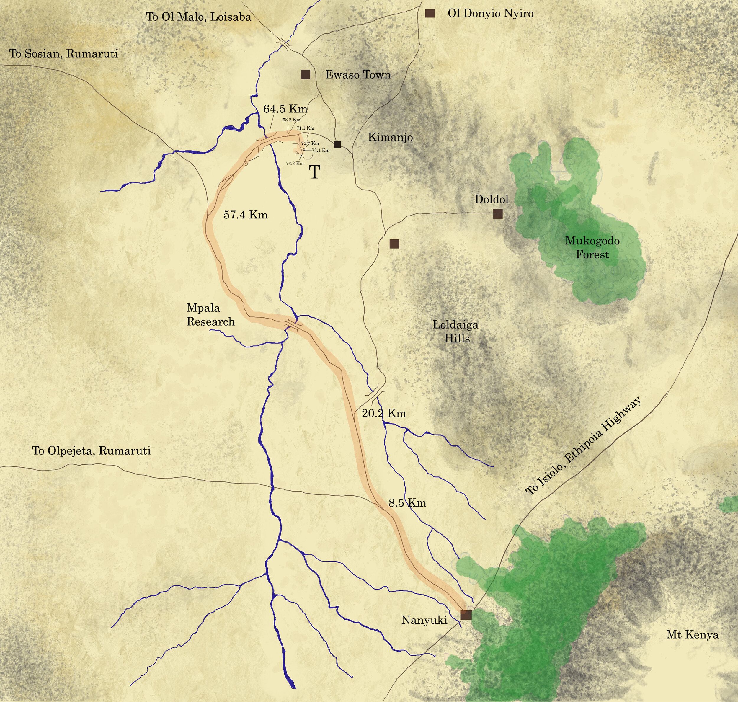
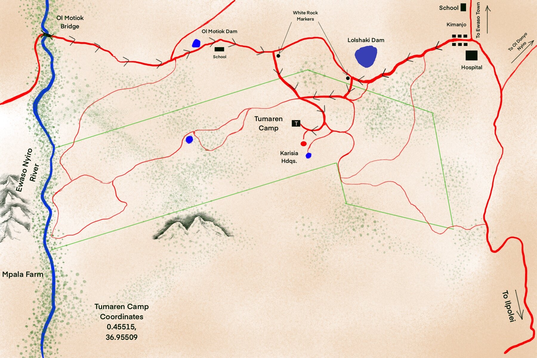
SPECIAL NOTE: The first thing to know about getting to Tumaren is that if you ask Google Maps or other Mapping software to navigate you to Tumaren (and much of Laikipia) , that it will guide you over terrible roads that are largely private. Instead use the digital MAPS (Gaia or GoogleMaps) below (East route or West Route) or alternatively print the last map on this page and navigate, depending on your preferred route, to Ol Motiok Bridge in the west OR Kimanjo Town in the East. Then you can safely navigate to Tumaren using a GPS from there.
Nanyuki to Tumaren Eastern Route:
(click the image to print)
Driving Nanyuki to Tumaren (East) Download Directions GPX or KML from Gaia GPS:
Nanyuki to Tumaren Western Route:
(click the image to print)
Driving Nanyuki to Tumaren (West) Download Directions GPX or KML from Gaia GPS:


